
Mixed construction fleets
Construction Fleet Dash Cams for Mixed Fleets
On a mixed construction fleet, AI dash cams go on the utes, vans and trucks, GPS trackers go on the excavators, generators and trailers, and Bluetooth tags and QR labels go on the tools, all in one register in MapTrack. Each camera has GPS built in, so a camera vehicle doesn’t need a separate GPS tracker, and its event clips, location, trips and estimated run hours and kilometres sit on its own record.
Cameras from $795 ex GST ($874.50 inc GST), with month-to-month plans from $34 ex GST ($37.40 inc GST) a month.
Ships 5-10 business days after you accept your quote. Freight is quoted with your order. 12-month manufacturer's warranty. 30-day returns.
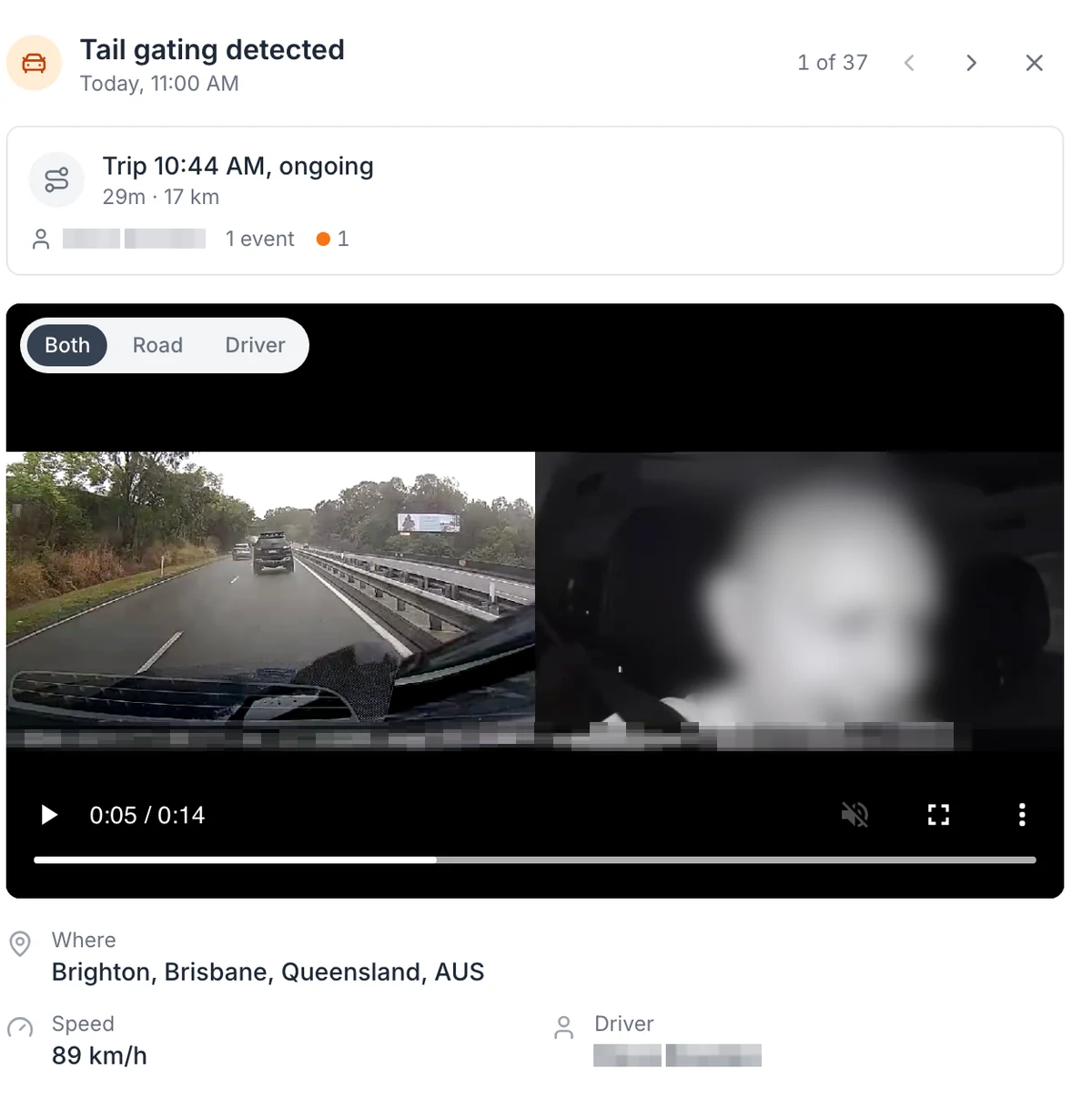
A tailgating alert, with the road and the cab side by side
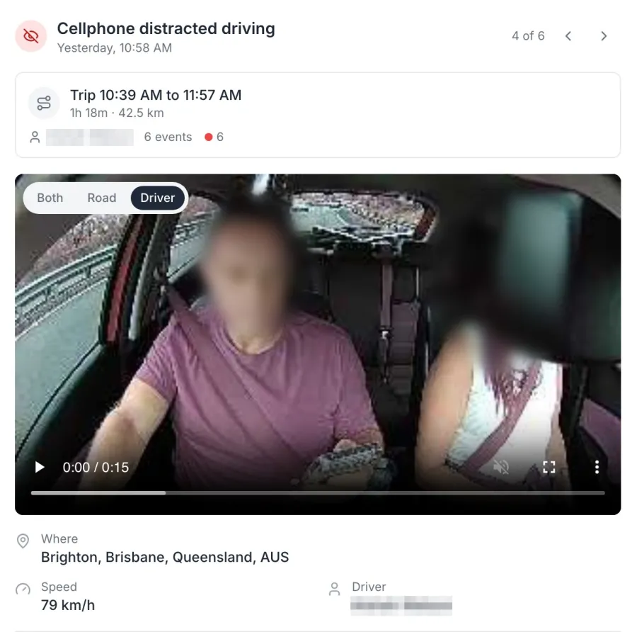
An AI dash cam event as it opens in MapTrack: the clip from the road and cab cameras together, the trip it happened on, the speed at the time and the suburb. Road and Driver views are one tap away. The face is blurred in this screenshot, and the driver name is masked.
MapTrack app · Demonstration data · Captured
About this screenshot
Demonstration account at a 1440 px desktop viewport. The event drawer is cropped from the device page. The driver’s face is pixelated and blurred, and the driver name and the clip’s burnt-in position overlay are masked.
Trusted by construction, mining and field service teams















“MapTrack has completely transformed how we manage our tools, equipment and fleet.”
What goes on what
Most construction fleets mix all of these. Each one lands on the record of the thing it’s fitted to.
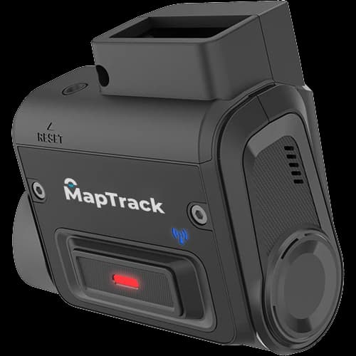
Utes and vans
MapTrack RoadSight or DualSight AI dash cam
Road only, or road and driver. Event clips, location, trips and estimated kilometres land on the vehicle’s record, so it doesn’t need a separate GPS tracker.
Ute and van dash cams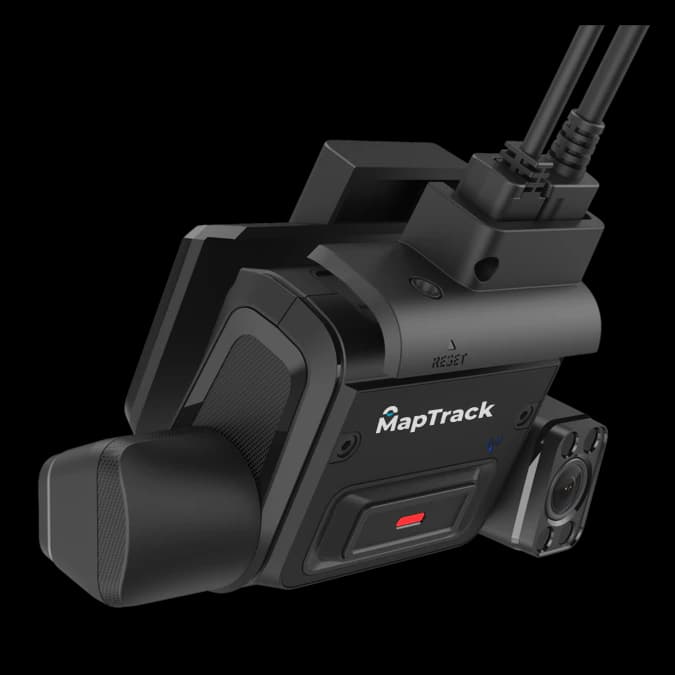
Rigid trucks, tippers and prime movers
MapTrack DualSight or Panorama AI dash cam
The DualSight records the road and the driver, with driver monitoring on the Advanced plan. The Panorama takes extra cameras for blind spots or the load; its plan and how it connects to MapTrack are confirmed with your quote.
Truck dash cams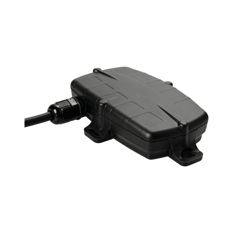
Excavators and other machines
Hardwired or battery GPS tracker
Estimated run hours from the tracker keep the hour meter current, so services fall due on use. Cat, Komatsu, JCB and Volvo machines can feed their own engine hours instead, set up by our team.
GPS trackers for excavators
Generators and trailers
Battery GPS tracker, such as the Barra GPS
A battery tracker suits portable and towed generators, and trailers with no power of their own. A set with its own battery can take a hardwired tracker.
GPS trackers for generators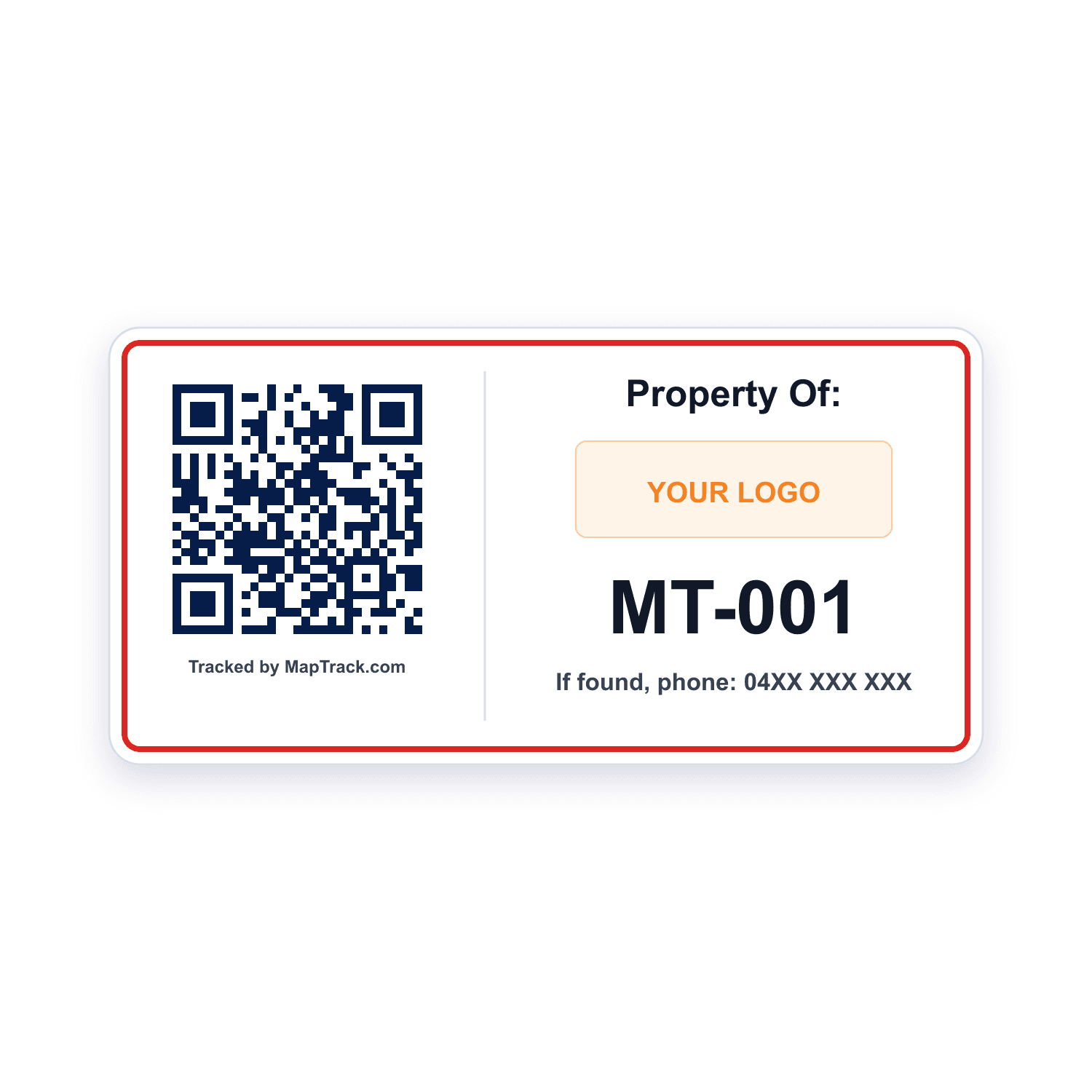
Tools and small gear
QR labels and Bluetooth tags
Scan a QR label to check a tool out to a person, the crew’s ute or a site. A Bluetooth tag updates its location when a gateway tracker such as the Dart3 or G70 picks it up; a camera doesn’t read tags.
Contractor tool tracking
One record for the vehicle
The camera is part of MapTrack, not a second system. Its GPS puts the vehicle's location and trips on its own record, and completed trips add estimated run hours to its meter, so services set on hours fall due on real use. The same record holds the vehicle's pre-starts, services and costs, beside your plant, trailers and tools.
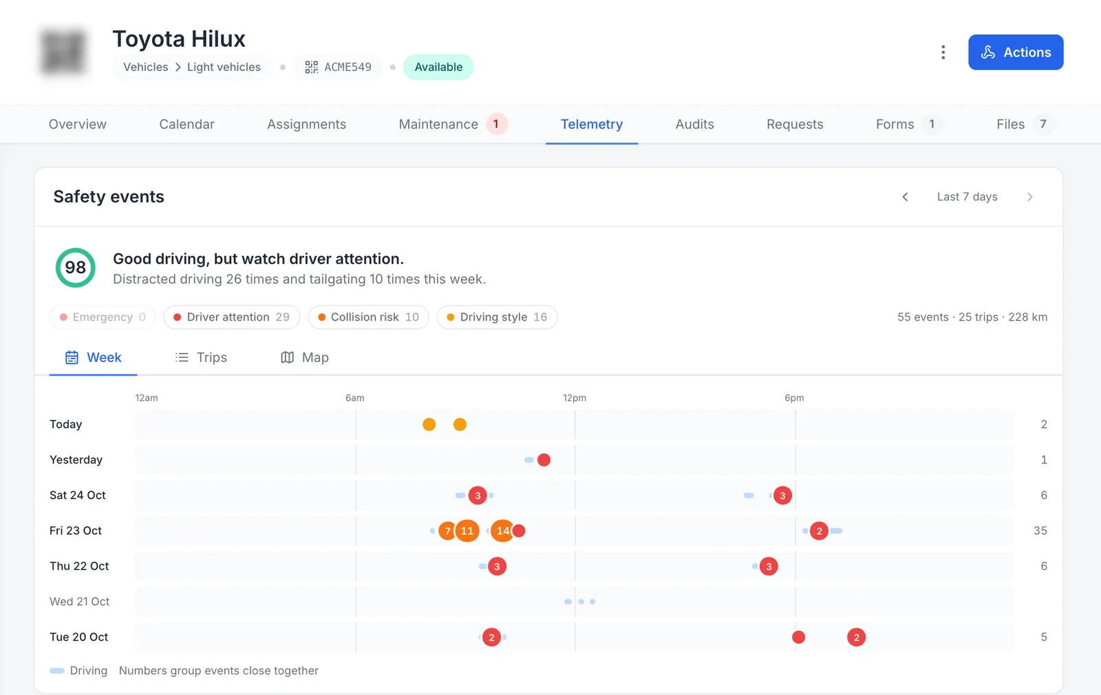
The camera’s week on the vehicle’s own record
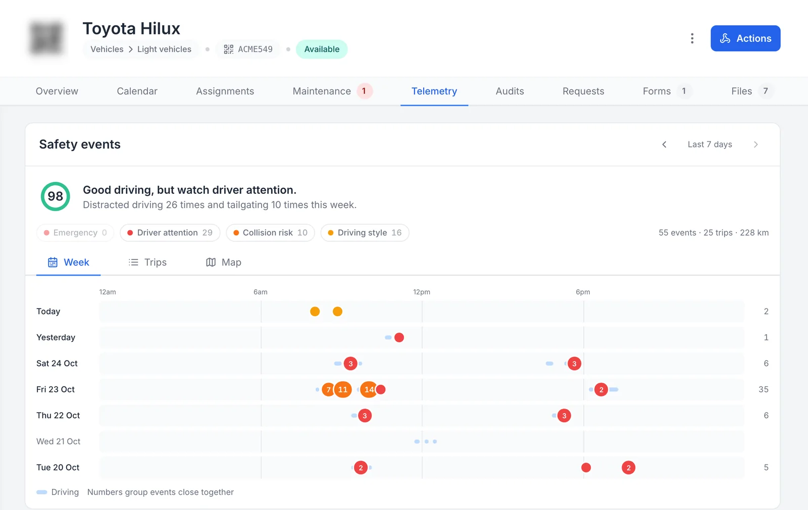
The camera’s safety events sit on the vehicle’s own record, on the Telemetry tab beside its maintenance, inspections and files.
MapTrack app · Demonstration data · Captured
Open full size screenshot: The camera’s week on the vehicle’s own record (new tab)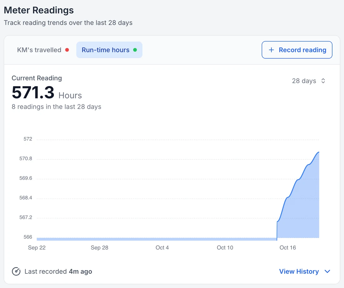
Run hours on the vehicle record
Completed trips add estimated run hours to the vehicle’s meter, so services set on hours fall due on real use.
MapTrack app · Demonstration data · Captured
Open full size screenshot: Run hours on the vehicle record (new tab)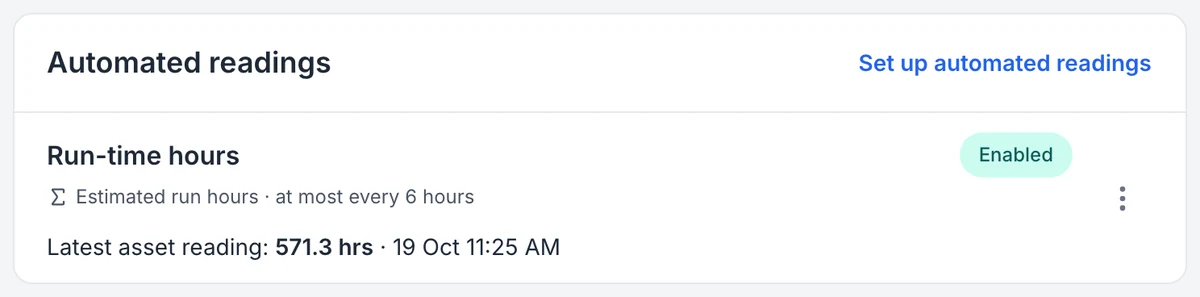
The reading the camera sends, and how often
MapTrack labels the reading an estimate and shows how often it updates. Time spent idling isn’t counted.
MapTrack app · Demonstration data · Captured
Open full size screenshot: The reading the camera sends, and how often (new tab)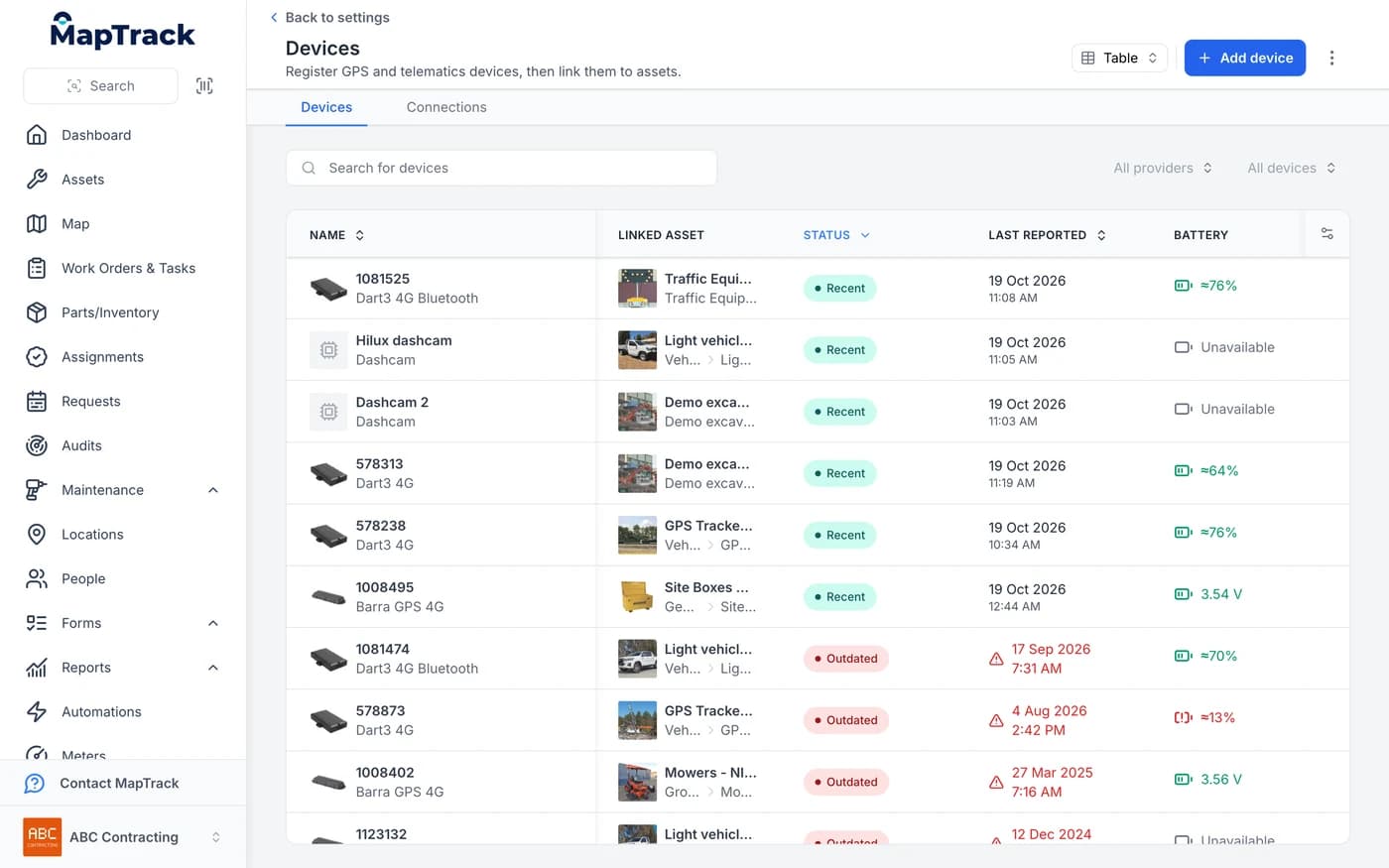
Cameras and trackers in one device list
The camera sits in the same device list as your GPS trackers, linked to the asset it’s fitted to.
MapTrack app · Demonstration data · Captured
Open full size screenshot: Cameras and trackers in one device list (new tab)
When a service falls due, you raise the work order from the schedule in a couple of clicks. Camera footage, live view and safety events are visible to account owners only.
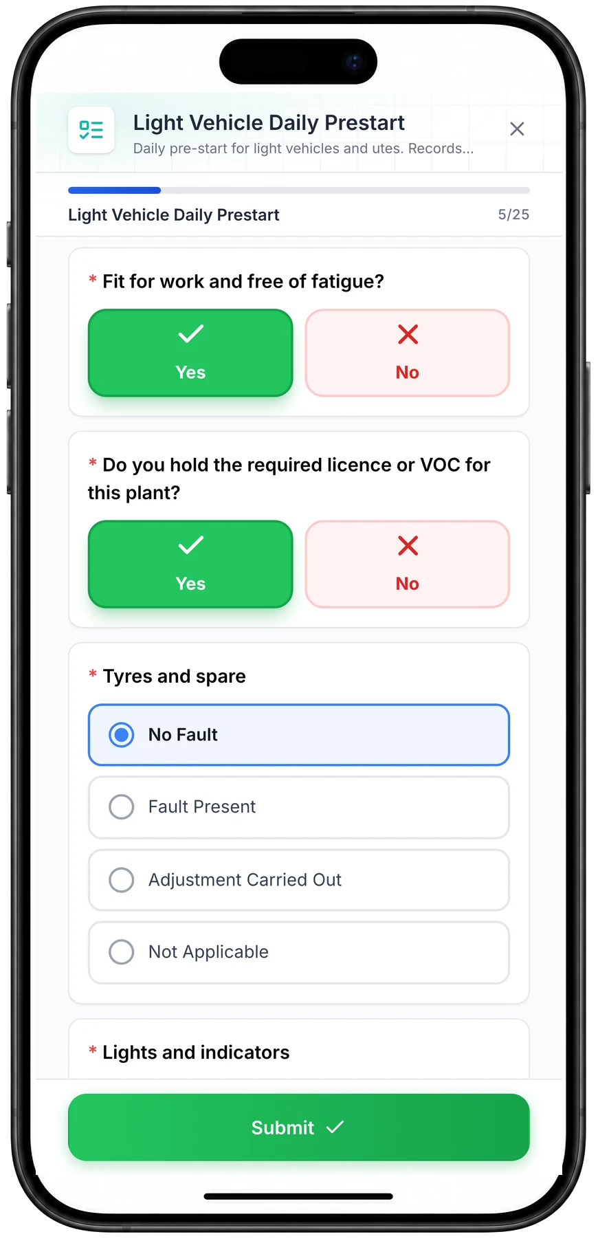
The pre-start sits on the same record
Drivers scan the QR label in the cab and run the daily pre-start on their phone. It lands on the same vehicle record as the camera's trips and events.
“Through the forms feature, we've been using daily safety truck checks. So our mechanic here completes that every day, as well as the truck drivers.”
What you see in MapTrack
These are from one of the cameras in our demonstration account, captured in the MapTrack app.
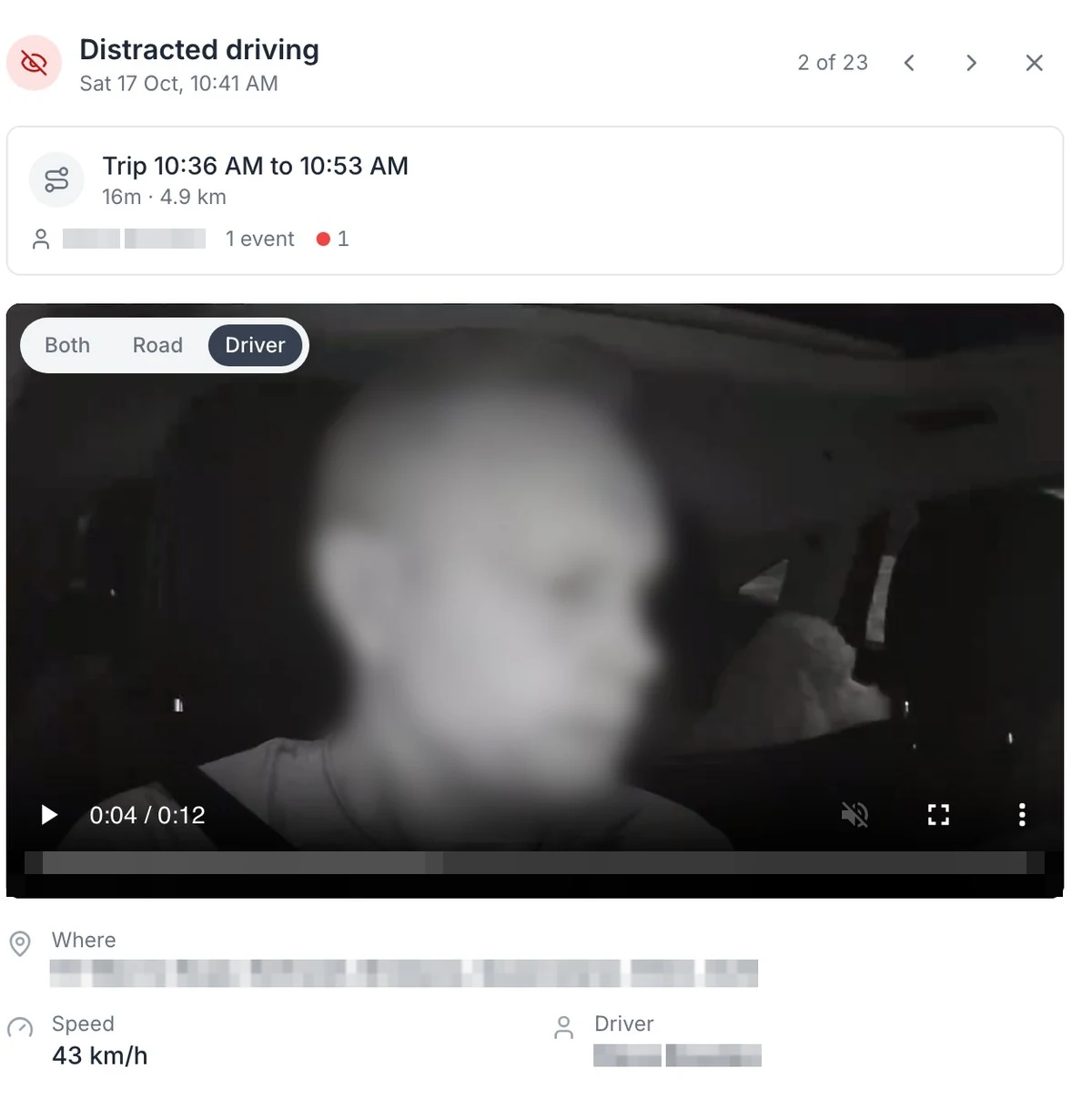
Distracted driving, on the camera facing the driver
On the DualSight, the camera facing the driver picks up distraction, fatigue and phone use on the Advanced plan. The face is blurred here.
MapTrack app · Demonstration data · Captured
Open full size screenshot: Distracted driving, on the camera facing the driver (new tab)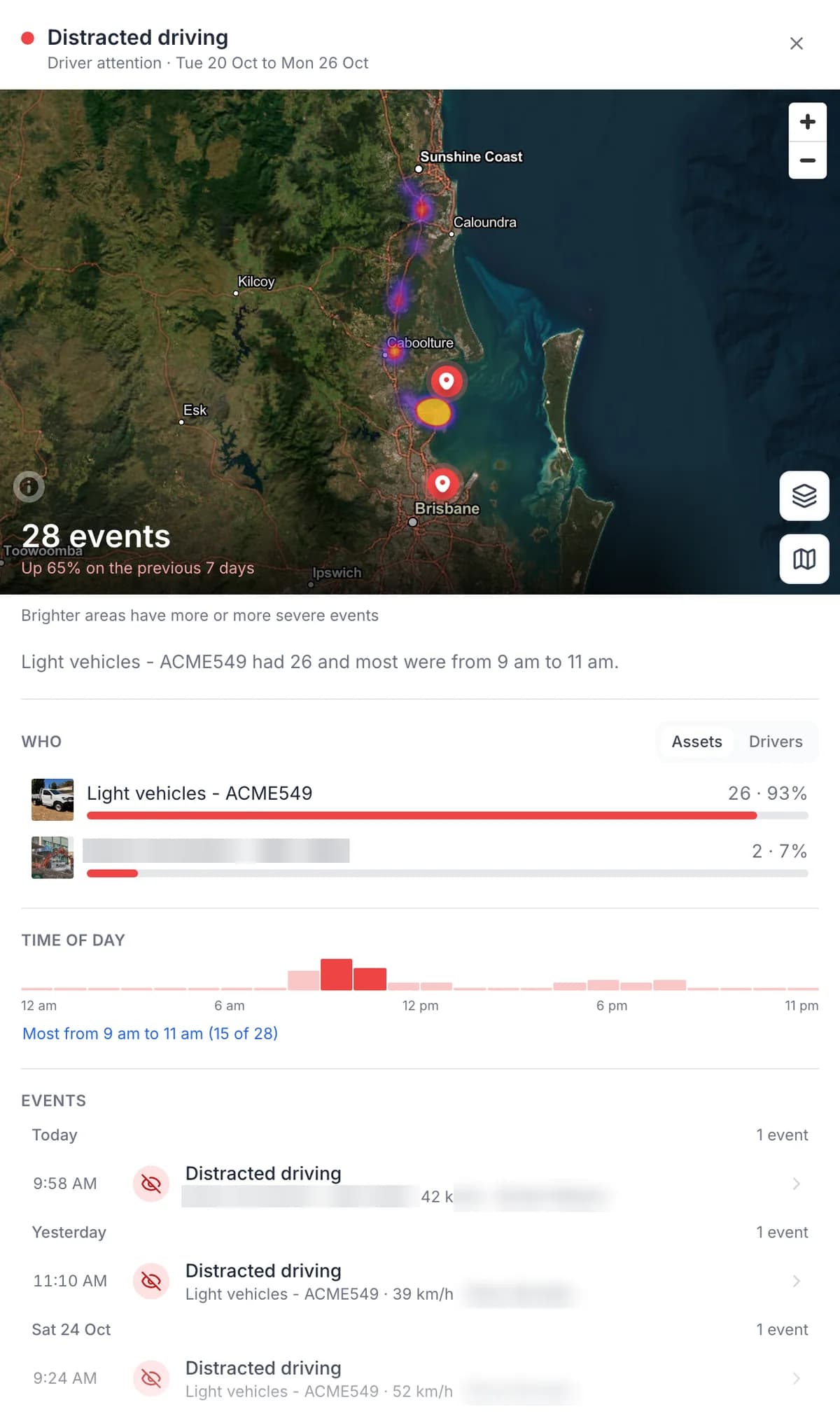
One event type: where, who and what time of day
Pick an event type to see how many, where, which vehicles and what time of day. Driver names are masked here.
MapTrack app · Demonstration data · Captured
Open full size screenshot: One event type: where, who and what time of day (new tab)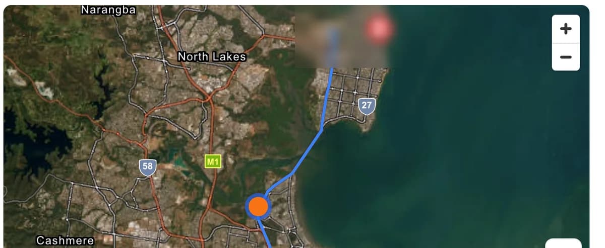
The trip’s route and where the alert happened
Each event opens with the trip it happened on: the route, and a marker where the alert fired.
MapTrack app · Demonstration data · Captured
Open full size screenshot: The trip’s route and where the alert happened (new tab)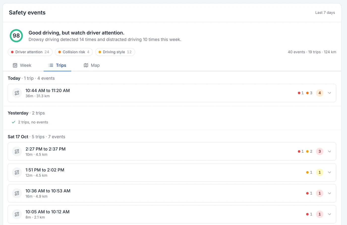
Every trip, with the events on it
Every trip is logged with its times and kilometres, and the events that happened on it.
MapTrack app · Demonstration data · Captured
Open full size screenshot: Every trip, with the events on it (new tab)
What the AI catches
Short clips of real events, saved by the camera with the speed and place. Which alerts are live depends on the camera and your plan.
On the road
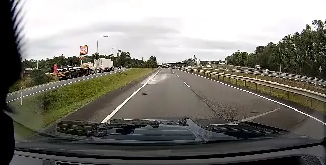
Speeding alert at 111 km/h.
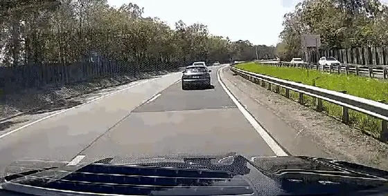
Tailgating alert at 94 km/h, road camera.
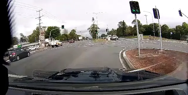
Harsh braking alert at the lights.
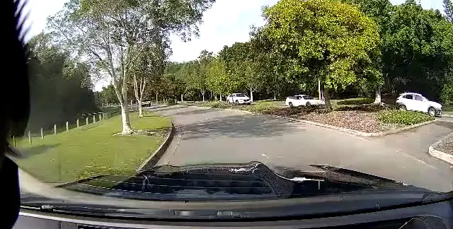
Harsh cornering alert at a roundabout.
In the cab
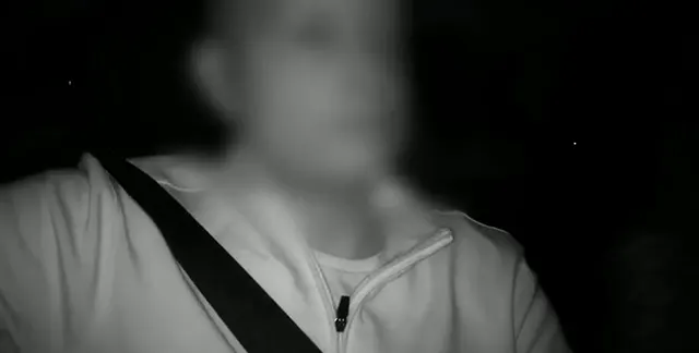
Drowsiness alert on the driver camera at night (infrared). Face blurred for privacy.
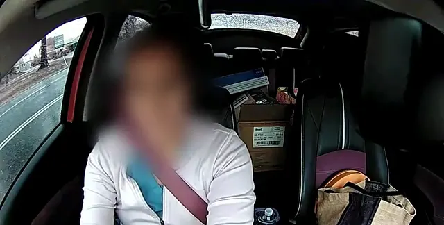
Eyes-down distraction alert at 66 km/h in the rain. Face blurred for privacy.
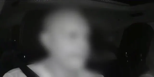
Distraction alert: head turned away from the road. Face blurred for privacy.
A privacy lens cap is available for the driver-facing lens. Workplace surveillance rules differ by state, so check your obligations and tell your drivers before you fit driver-facing cameras.
New in MapTrack
Every camera on one safety dashboard
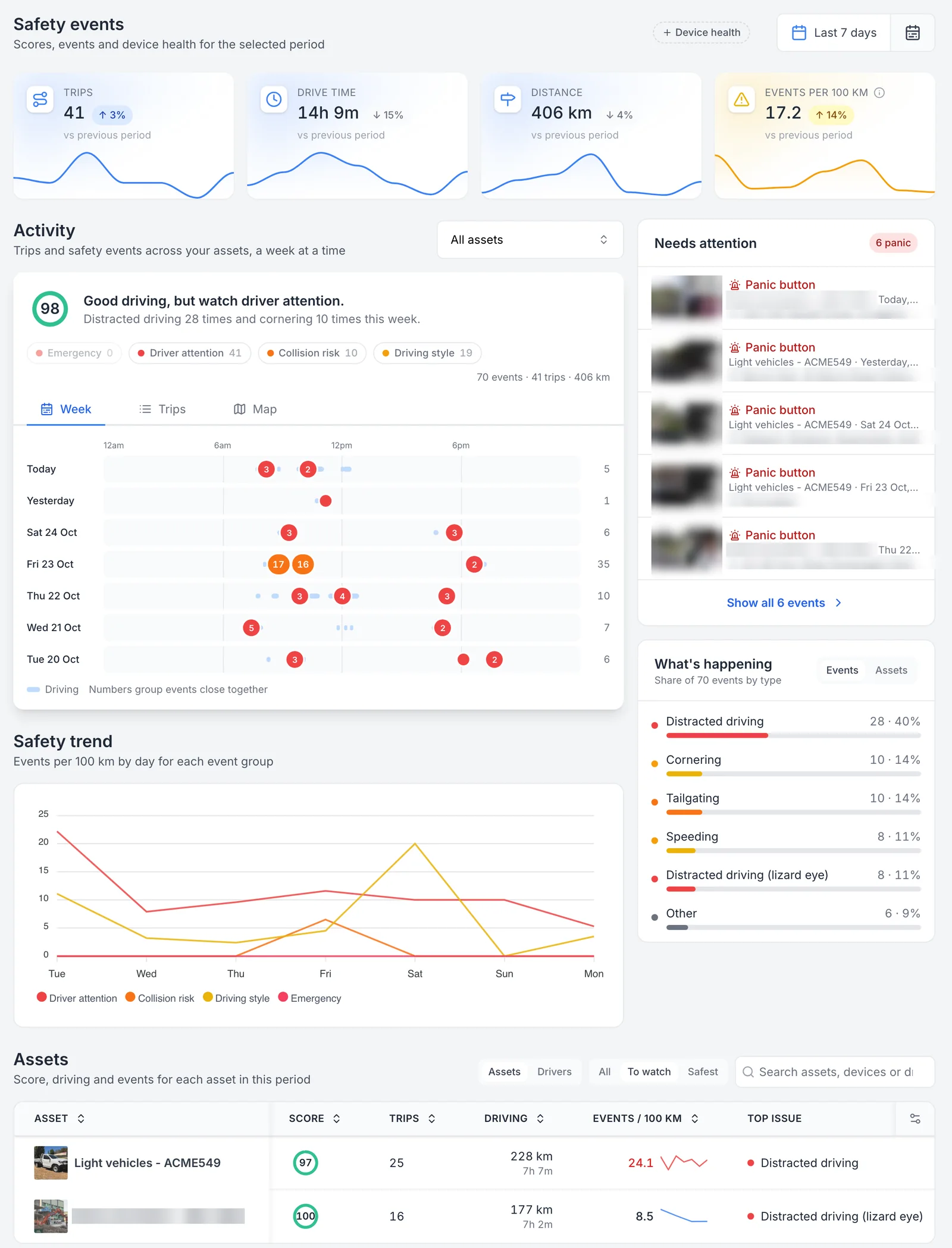
The Safety events dashboard in MapTrack brings every connected camera into one view, so you can see how the whole fleet is driving, not one vehicle at a time. It sits under Devices, and camera footage and safety events are visible to account owners only, because they're personal to the driver.
- Trips, drive time, distance and events per 100 km for the whole fleet, each against the previous period.
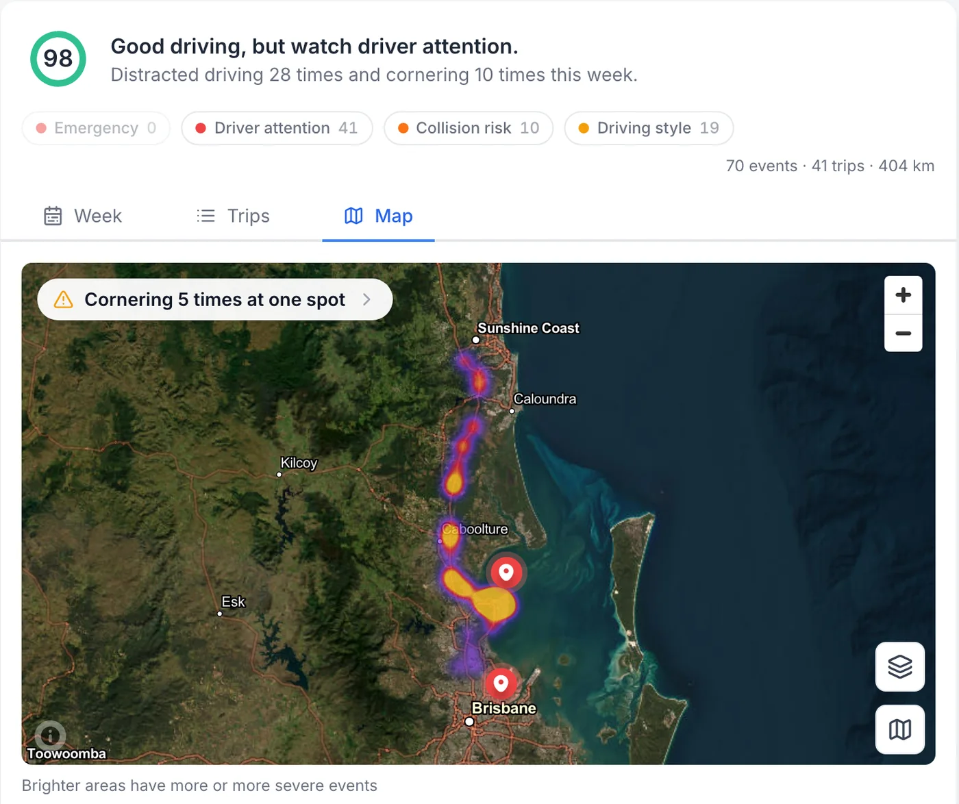
- A week view that shows when events happen, and a heat map that shows where. When one kind of event keeps happening at the same spot, MapTrack flags it.
- Needs attention lists the events to look at first, such as panic button presses.
- Click an event type to see how many, where, which vehicles or drivers, and the time of day it happens.
- A table ranks every vehicle, or every driver, by safety score and top issue, with To watch and Safest filters.
- Date ranges from today back to the last quarter, and every vehicle’s own record keeps its camera’s week.
Every camera’s safety events on one page
Released on 25 October 2026: one page for every camera in the fleet. Trips, drive time, distance and events per 100 km sit against the previous period, the week shows when events happen, Needs attention lists panic button presses first, and the Assets table ranks each vehicle by its score and top issue. Thumbnails, street addresses and one demonstration asset name are masked.
MapTrack app · Demonstration data · Captured
About this screenshot
Demonstration account at a 1440 px desktop viewport, signed in as an account owner (camera data is owner-only). Settings, Devices, Safety events over the last 7 days, Assets table filtered to To watch. Event thumbnails, street addresses and one demonstration asset name are pixelated.
Where the fleet’s events happen, as a heat map
The same week on the map for the whole fleet. Brighter areas have more or more severe events, and when one kind of event keeps happening in the same place, MapTrack flags the spot, here cornering five times at one spot.
MapTrack app · Demonstration data · Captured
About this screenshot
Demonstration account at a 1440 px desktop viewport, signed in as an account owner. Safety events dashboard, Activity on the Map view at its opening zoom over the last 7 days.
The camera’s week on the vehicle’s own record
The vehicle’s own record carries its camera’s safety events, on the Telemetry tab next to its maintenance, inspections and files. The arrows step back a week at a time.
MapTrack app · Demonstration data · Captured
About this screenshot
Demonstration account at a 1440 px desktop viewport, signed in as an account owner. Asset record, Telemetry tab, cropped to the header and the Safety events card. The asset QR code is pixelated.
See it on your own fleet
We'll show you the dashboard on a 30-minute call, work out which camera and plan each vehicle needs, then send the quote.
Where the location shows
A camera’s location and trips land on the vehicle’s record in MapTrack. For GPS trackers, the app shows each asset’s latest position, and live tracking, trips, history and boundary alerts run in MapTrack Telematics.
Cameras on the road vehicles, trackers on the plant
Utes, vans and trucks are out on public roads, so that’s where a camera does its work: a saved clip of harsh braking, a hit or an AI alert, stamped with the GPS location, speed, date and time.
On an excavator, a generator or a trailer the questions are different: where is it, how many hours has it done, and when is its next service due? A GPS tracker answers those.
The AI alerts on this page are road and driver alerts for vehicles on the road. Nothing on this page is a proximity or pedestrian detection system for plant.
One register for vehicles, plant and tools
Utes, vans and trucks sit in the same register as the excavators, generators, trailers and tools, each on its own record with the label, tag, tracker or camera that suits it. Pre-starts, services, rego dates and files for all of them sit in one place, so nobody keeps a separate list for the vehicles.
The camera sits in the same device list as your GPS trackers, linked to the asset it’s fitted to.
What the cameras save
The camera records to its card on a loop. When it picks up an event, it saves a clip stamped with the GPS location, speed, date and time. In MapTrack, that clip opens with the trip it was on, the speed and the suburb.
Live road alerts for tailgating, forward collision warnings, lane departure and harsh braking are on the Pro plan. Driver alerts for fatigue, distraction, phone use, seatbelt and smoking are on the Advanced plan with the DualSight.
Where the week’s events happened
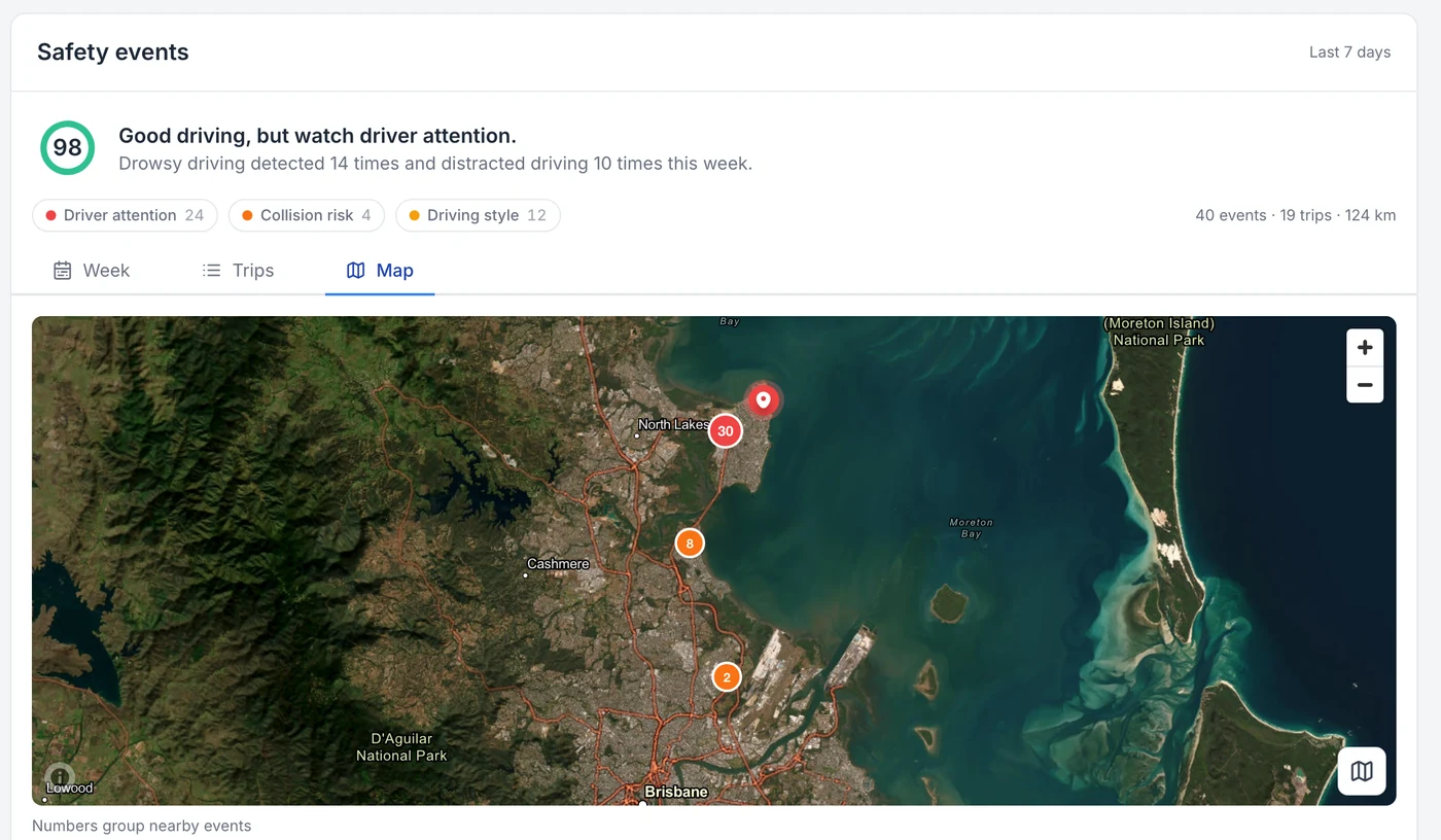
The week’s events on a map, grouped where they cluster together. This is the view as it opens; zooming in separates the clusters into individual events.
MapTrack app · Demonstration data · Captured
About this screenshot
Demonstration account at a 1440 px desktop viewport, Map view on the device page at its opening zoom.
Remote sites and mobile coverage
The DualSight can be set up to send its data and video over a vehicle-mounted Starlink’s Wi-Fi instead of mobile data. It then uses Starlink only, with no automatic fallback to its SIM: if Starlink is off or unavailable, the camera keeps recording to its card, subject to storage and power, and uploads and video requests wait until Starlink is back. We set it up with you before it goes in the vehicle.
See which vehicles to work on
The Safety events dashboard in MapTrack puts every camera on one page: trips, drive time, kilometres and events per 100 km for the fleet against the previous period, with a heat map of where events happen. Click an event type to see how many there were, where, which vehicles or drivers, and the time of day.
Camera footage and safety events are visible to account owners only, so your crews can use MapTrack for pre-starts and check-outs without seeing driver footage.
Fit and power
All three cameras are hardwired. The RoadSight and DualSight run on 12 to 32 volt power, which covers 12 V utes and 24 V trucks, and all three are rated to run from minus 20 to plus 60 degrees.
We coordinate installation with your quote, and we’ll go through each vehicle type on a 30-minute setup call before anything ships.
Not sure which camera each vehicle needs?
We'll go through it with you on a 30-minute call, then send the quote.
The cameras
Commercial AI dash cam with road-facing and infrared driver-facing 1080p cameras, GPS, and video in MapTrack. Driver monitoring on the Advanced plan. 128GB industrial card included.
- Dual-facing 1080p HD cameras (road + driver)
- Driver monitoring on the Advanced plan: fatigue, distraction, phone use
$995 ex GST($1,094.50 inc GST)
+ camera plan from $34 ex GST($37.40 inc GST) a month, plus the vehicle's MapTrack plan
Road-facing AI dash cam for commercial vehicles. Full HD forward recording, 4G LTE, GPS and video in MapTrack. No driver-facing camera.
- Road-facing 1080p Full HD camera, 142° diagonal field of view
- Live ADAS alerts on the Pro plan: tailgating, lane departure, harsh braking
$795 ex GST($874.50 inc GST)
+ camera plan from $34 ex GST($37.40 inc GST) a month, plus the vehicle's MapTrack plan
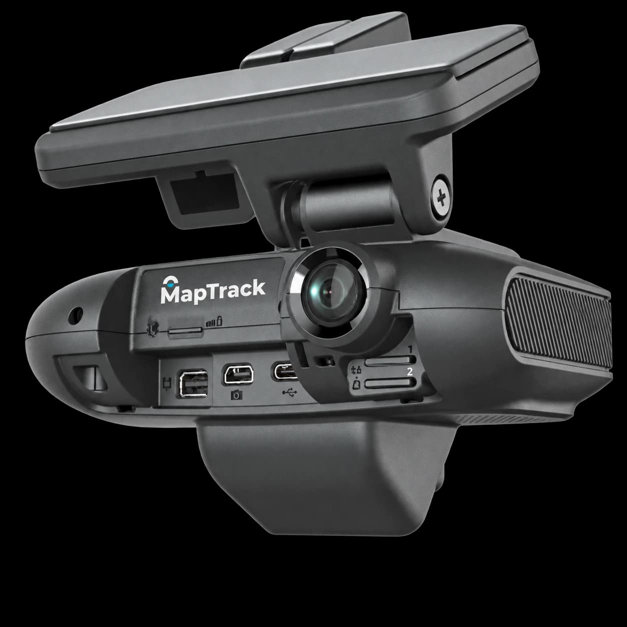
Road-facing and driver-facing AI dash cam with connections for extra cameras, for vehicles that need more viewpoints. 2 x 512GB storage included.
- Road-facing 1080p Full HD camera, 142° diagonal field of view
- Driver-facing camera
$1,519 ex GST($1,670.90 inc GST)
Plan confirmed with your quote
Compare the cameras
| Feature | RoadSight | DualSight | Panorama |
|---|---|---|---|
| Road-facing camera | 1080p, 142° | 1080p, 142° | 1080p, 142° |
| Driver-facing camera | No | Yes, infrared | Yes |
| AI driver alerts | No (no driver camera) | Phone use, fatigue, distraction, seatbelt, smoking (Advanced plan) | Confirmed with your quote |
| Extra cameras | None offered | 1 USB camera | Up to 4 TVI + 1 USB |
| Storage included | Confirmed with your quote | 128GB | 2 x 512GB |
| Monthly plans | Standard, Pro | Standard, Pro, Advanced | Confirmed with your quote |
| 1 to 9 cameras | $795 ex($874.50 inc) | $995 ex($1,094.50 inc) | $1,519 ex($1,670.90 inc) |
| 10 to 99 cameras | $649 ex($713.90 inc) | $799 ex($878.90 inc) | $1,219 ex($1,340.90 inc) |
| 100+ cameras | $584.10 ex($642.51 inc) | $719.10 ex($791.01 inc) | $1,097.10 ex($1,206.81 inc) |
Prices, volume bands and every plan are on the fleet and commercial AI dash cams page.
Construction fleet dash cams FAQ
What’s the best dash cam setup for a construction fleet?
Can one system cover dash cams, plant trackers and tools?
Do you put AI dash cams on excavators?
Does a ute with a dash cam still need a GPS tracker?
Can machines with their own telematics feed into MapTrack?
Do the cameras work on remote sites out of mobile coverage?
Who can see the footage?
How much do construction fleet dash cams cost?
Choosing fleet cameras
Guides and tools
Talk it through before you order
We'll go through your vehicles, which camera and plan each needs, and installation on a 30-minute call, then send the quote.